Construction of the pier :
In several initial projects, access to the sea was planned via a canal linking the water bodies of Port-Grimaud to the Giscle. However, to avoid a long transit time, but also in view of the risk of flooding the town in the event of high water, and with the authorisation of the Maritime Affairs, the passage was made through the beach, at the level of the Place du 14 Juin. Thus the architect, thanks to this direct access to the sea, added 14 km to the French coastline...
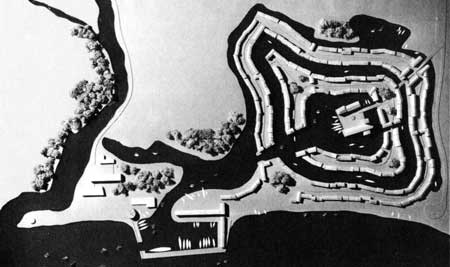
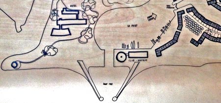
Premier ground plan :
On the first mass plan of the section along the beach, one can discover a site planned for a
yacht club, the
fueling station,
a small harbour for the hotel and a
children's day-care center in the centre of the 14th of June square...
The sea trip was planned on the Giscle...
The first pear :
Between December 1966 and February 1968, while the architect was working on what was to become his lake city,
the beach receded by 20 to 25 metres!!!
François SPOERRY decided, on the advice of the Ponts et Chaussées engineers of the time, to build a jetty that would neutralise the action of the wind and sea and hold back the sand...
The work was entrusted to the SPADA team of specialists from Nice led by Maurice CARUSO, and began on 15 March 1968.
They started with an experimental cob that would serve as a base for the future pier. It was straight.
Opened at the beginning of the summer of 1968 for the pleasure of the first owners and summer visitors, the channel was closed from mid-October 1968 to the spring of 1969 in order to extend the pier with a curved breakwater.
Once this single groin was completed, the shoreline was fully stabilised and the beach on its northern side (PG1 beach) was seen to be growing.
The beach at PG2 will serve as a
sand trap.
projects of pier :
2 projects to create access to the seafront...
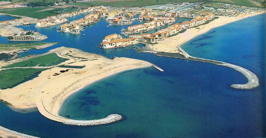
But the project that was chosen was a curved pier.
This pier remains one of the technical curiosities of the lakeside city because of its curved shape, which provides better resistance to the force of the waves...
Composition
The jetty is made up of 60 tonnes of sheet piling, 250m3 of poured concrete and granite blocks, each weighing between 5 and 7 tonnes, from the quarry on the Route du Plan-de-la-Tour.
It took 22 lorries doing ten shifts a day to move 24,000 tonnes of riprap...
The jetty is 126m long and can be moored along 120m of the entrance channel. Dredging the channel represents 12,000 m3 of sand to be removed and transported.
The jetty along the mouth of the Giscle also had to take on a curved but opposite shape to respect the new direction of the Giscle and to align itself with that of the Marines de Cogolin...
Aerial view of Port Grimaud in 1970
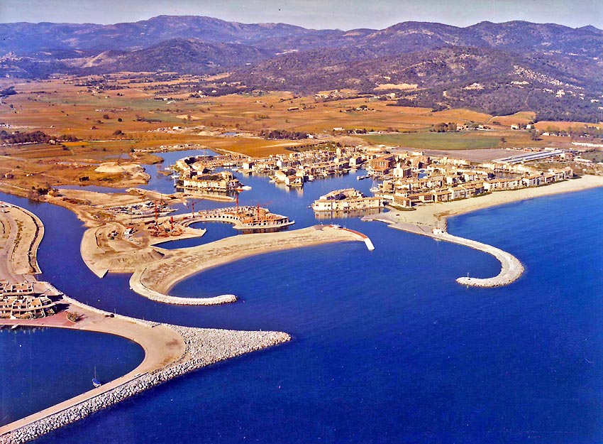
Aerial view of Port Grimaud in 1974
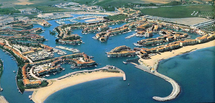
Aerial view of Port Grimaud in 1980
The Harbour Master's Office :
The Capitainerie of PG1 was a necessity to accommodate all the boats wanting to stay in the city. It is located to the right of the entrance pass and at the beginning of the curved spur. It was built in the same style as the rest of the city: Provençal, uncluttered, discreet and yet very visible.
At the beginning of the century, the current president of the Port Grimaud 1 ASP wanted to modify it by enlarging its surface area and by raising it with a glass post like an airport control tower. Modifications that were too modern and too important for the lakeside town! Fortunately, this grandiose project was not retained!
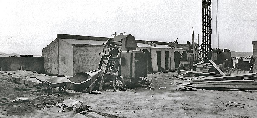
Construction of the Capitainerie
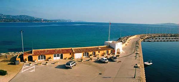
La Capitainerie, in 2003, a small building with a typical Provencal look.
SANDING :
These jetties and groynes, built at the time to facilitate the departure of boats to sea and stabilise the sand, served their purpose until around 2000/2010.
Unfortunately, the Giscle River floods became more numerous, transporting more sand which, during high tide, was deposited in front of the small beach of PG2 and the entrance channel. A dune of 30,000m3 was formed, requiring regular annual dredging of this channel... (See the page about ENSABLEMENT)